
Index
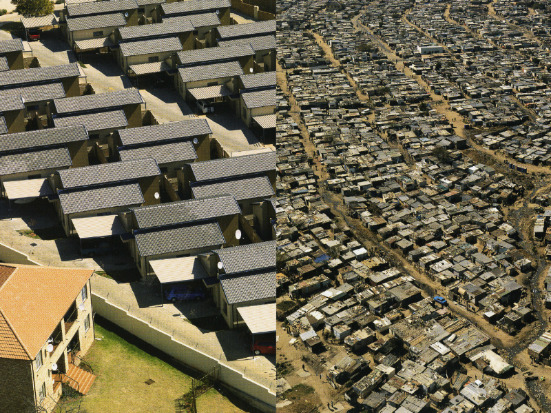
Photo by David Goldblatt, 2009
What creates a city’s identity? Is this power under the state? The people? Educational institutions? All of these factors play a role, and they are further complicated by the establishment of a non-democratic regime such as the apartheid in South Africa. It is also clear that both city and state would seek to reestablish their identities when the political situation at last changes. Architecture plays an important role throughout this process, creating an instant, concrete image, one that is visible to all. Buildings become monuments, and these monuments carry meanings – meanings that resonate within people. But what does this mean in the context of a settlement like Soweto in Johannesburg, South Africa, where the location as well as the historical and cultural development is as important as the architecture itself?
It is well-known that states use architecture and urban planning to reinforce their ideas of power and image. Capitol architecture is a good example of this: an imposing architecture where scale, style, materials and other characteristics define and pass a message of the power of that particular state. In Johannesburg, it was not in the government buildings where this image of power would be expressed, but in the planning of the townships, the housing neighborhoods created to accommodate the black labor force for the mining industry. In this case, architecture and urban planning were used to promote racial segregation, and expose the white supremacy. According to Partha Chatterjee, in Whose Imagined Community? in The Nation and its Fragments: Colonial and Postcolonial Histories, “Benedict Anderson demonstrated with much subtlety and originality that nations were not the determinate products of given sociological conditions such as language or race or religion, they had been (…) imagined into existence.” This could also be said of the townships in Johannesburg. At the end of the nineteenth century, planners would propose the introverted ‘urban village’ for those areas, where housing units would face inwards. In the urban planners’ view, that would stimulate sense of cohesion and sense of community.
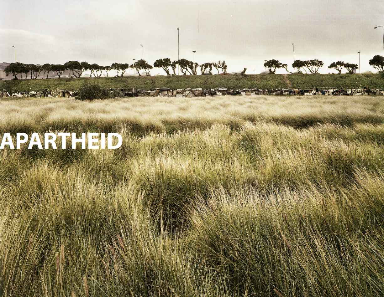
Later, in 1950, the Group Areas Act would define the guidelines for segregation, drawn once more with the help of architects and urban planners. Residential and working areas were defined according to race, and would even function independently of other areas. Moving to and from work, no race group was permitted to cross the residential area of another. The newly elected apartheid government would then address the shortfall of housing, but once more, under its own criteria and standards. Minimum space standards and optimum neighborhood densities would serve as guidelines for the ‘native housing’. The black labor force would be literally enclosed in the bantustans (or homelands), disconnected spaces located in marginal parts of the country. They were created according to the white minority discourse as places where black South Africans would live according to tribal custom and practice while providing labor reserves for the white industry. They were supposed to identify with this stigma, being completely disconnected from the modern world.
In this case, it is clear that architecture was used to create a fictional story about the black South Africans’ way of living. It was a story created to embrace the desire for racial supremacy of a white minority, according to Lindsay Bremnen in the book Writing the City Into Being- Essays on Johannesburg, the color of the skin became the associated with borders and movement within and across those borders. The central government, set by the minority white, wanted to cut costs on housing construction, extremely necessary for the dense lower-income black population. Once more architects would introduce materials, performance standards and methods to reduce construction costs, but these rules ended up promoting poor designs and space solutions for those areas, a heritage that remains even fifteen years after the end of apartheid. Their view on the Bantustan populations was that their projects would keep those people under their ‘own desire’ of living as ‘natives’ in a tribal and primitive ‘modern way’. From this perspective, if skin could be seen as an abstraction of ‘walls’ and possibility of movement through those walls, once more, architecture would have an important role in defining the South Africa image post-apartheid.
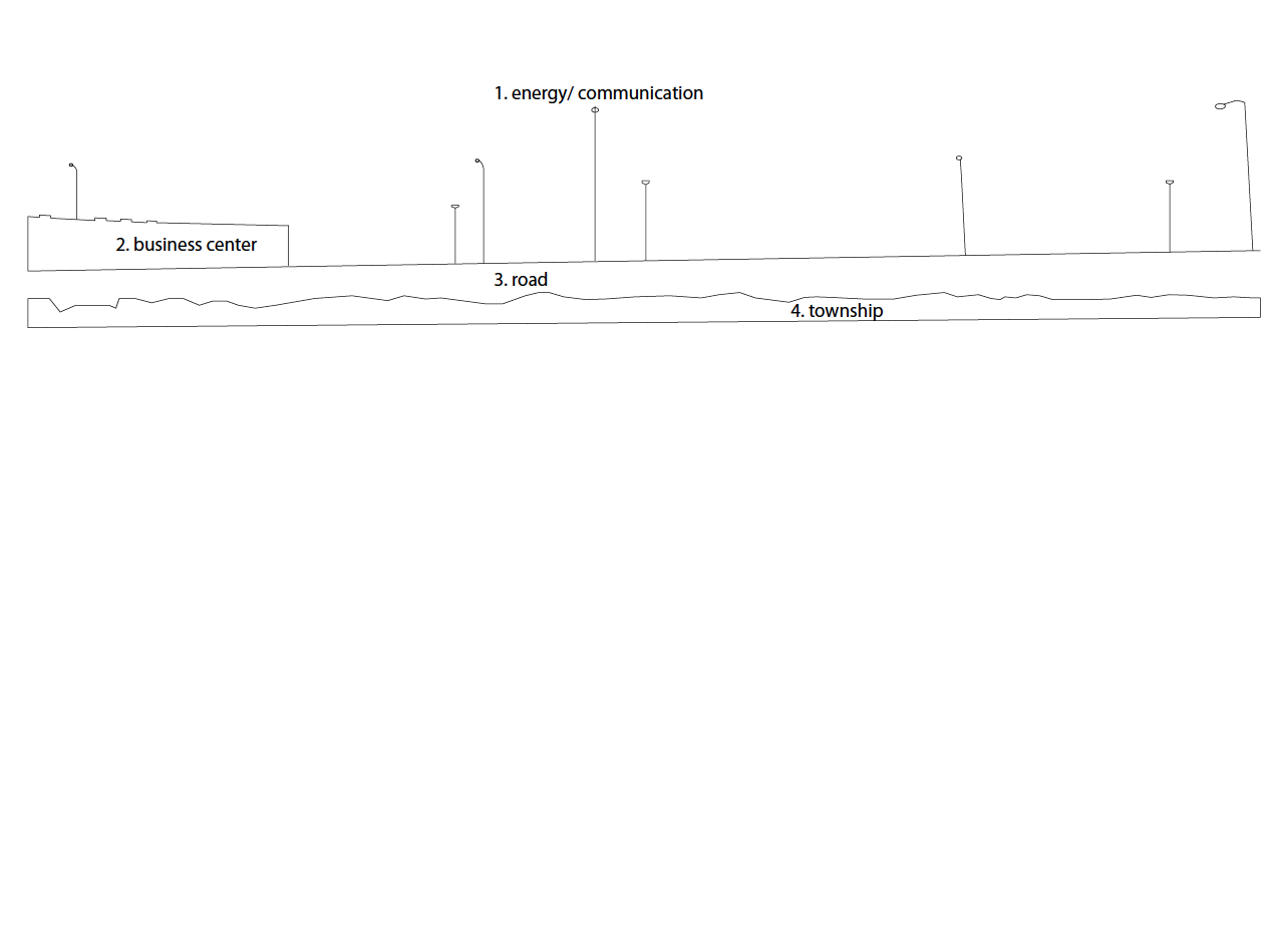
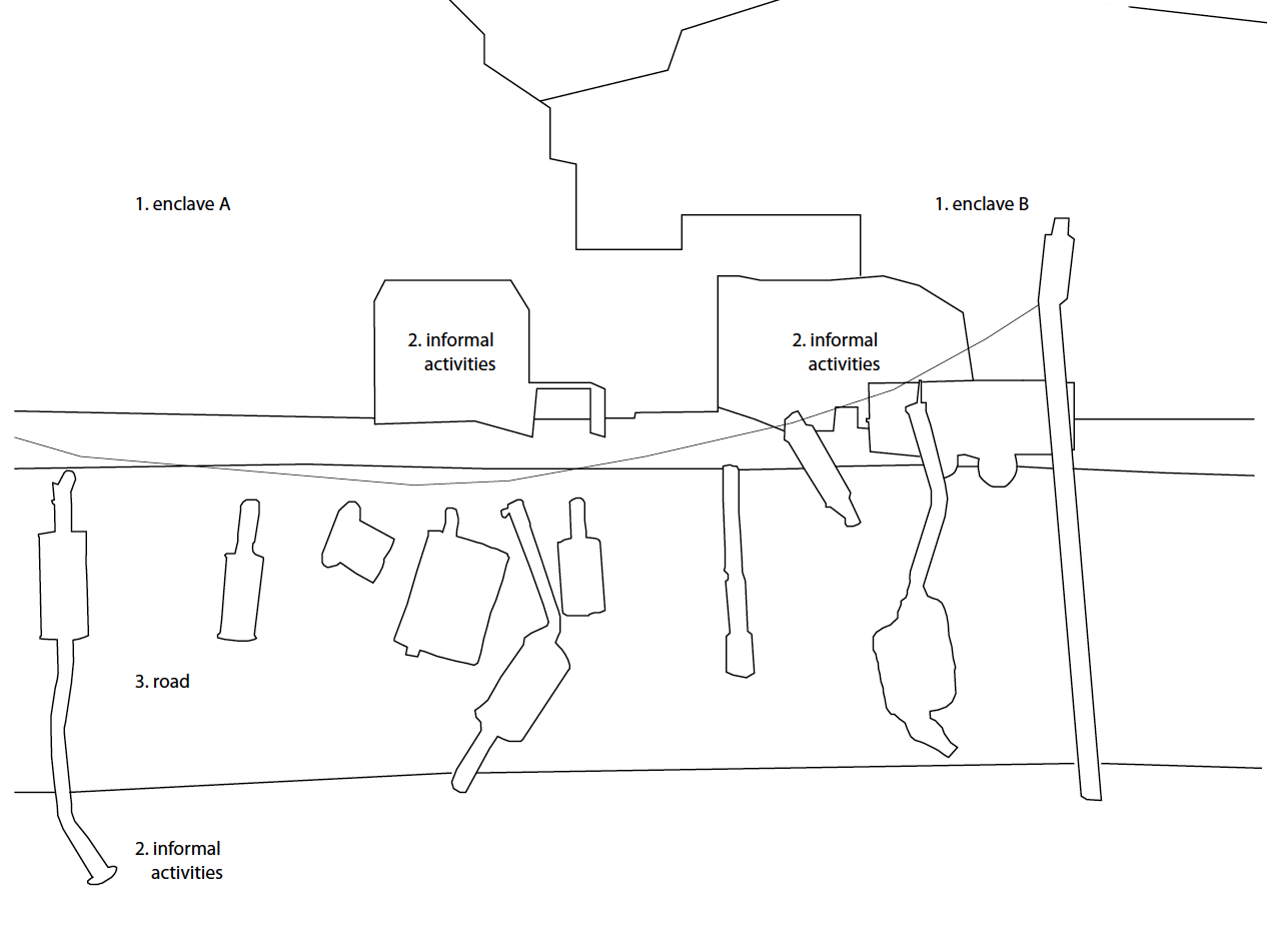
In 1984, when apartheid was reaching its emergency phase, with other countries boycotting South Africa in the international market, the first gated community in the country was built in the northwest suburbs of Johannesburg. Walls and gates would acquire new meanings in the new society, yet to be created. By the end of 2003, there were more than a 1,000 of these enclaves in the city. How does this affect the new identity of South Africa that is being created after the end of apartheid? Walls, electrified fencing, security gates, intercoms, razor wire, concealed cameras and armed guards - are those the elements that create the image and consequently the identity of South Africa post-apartheid? How do people feel today, having to transit between ‘militarized borders’? Could security systems define the image of a city and consequently its identity? The answer is still not clear, but people are transiting in this scenario and those elements have become part of ‘everyday life’ in Johannesburg.
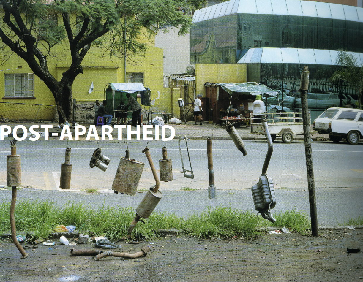
The Central Business District area, which emptied out due to the shift of the business offices to the northwest part of town during the late 80s and early 90s, would become a squatting area for low-income workers and refugees. Buildings considered landmarks, and which once represented the fragile economic prosperity of a society during the apartheid years, would now be the symbol of the urban decay of the CBD area. In contrast, areas such as Soweto are seeing a new phenomenon that once more is shaping, defining, and empowering a new kind of society. A shopping mall boom (six malls in the last six years) is underway in the Soweto area, and this is contributing to a growing middle class in that neighborhood. This new middle class is investing money to renovate their houses with new materials; no more corrugated metal sheets still present in many shacks in the township areas. New jobs are being created in this area, and the city is investing in infrastructure such as roads to provide access to Soweto.
Even though there has been progress, the poor quality of many buildings and homes as well as the geography and the way these neighborhoods are connected to the city remain as scars. Moreover, what could be a sign of development for Soweto could increase its isolation from the rest of the city, a situation that is already happening in the northwest area. More and more people are staying in the neighborhood rather than crossing town using the poor and unsafe transportation system to shop in areas such as CBD and Sandton. On a smaller scale, many residents are also having their houses enclosed by walls and gates. With the statistics showing that robbery is one of the most common crimes in the city (sometimes ending in murder to steal no more than $2.00 in areas such as Diepsloot), it is not that surprising that the only way some people would feel safe is inside walls.
The city is more open today than ever before, and places like Soweto seem to be developing a new and independent sense of pride and identity. This is a good thing, but continuing violence makes concerns about security a fact of life, not just in the central business district but in Sandton and Soweto as well. The end of the apartheid and the increase in xenophobia, violence and fear still stain the image of the city of Johannesburg and consequently, contribute to shadow the city’s identity.